Friday, October 23, 2015

Gathering Data and Assessing Accuracy

Goals and Objectives:

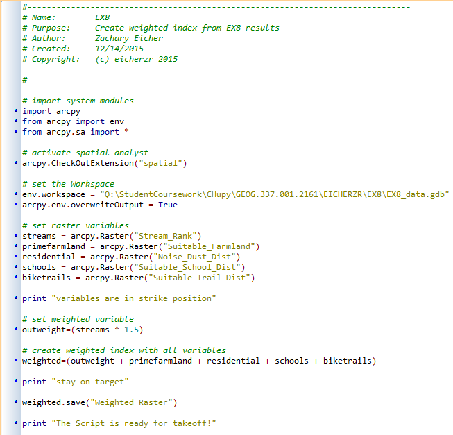
The goal of this lab was to familiarize myself with the process of gathering and downloading data from different organizations on the internet. After the data was gathered I had to import it into ArcGIS and project it from all of its different sources into a single common coordinate system. I also had to design a getodatabase to store all the data; this had to be done by writing python scripts in PyScripter. You can view my scripts here. The challenge of this lab was writing script that would actually work, as well as keeping all the downloaded data organized and easily accessible. Like all the posts/labs in this blog they share the common goal to build a risk and sustainability model for sand mining in western Wisconsin. All of the data downloaded for this lab was focused on Tremealeau County for purposes of proximity and to minimized the sheer amount of data stored.

Methods:

The first step in this lab was to obtain our data from the internet (Figure A) . Below is a list of the specified data sources required for this lab.


Figure A: a basic work flow created by Professor Hupy provided for us in our instructions.

All the datasets were downloaded to a temporary file, they were then unzipped, extracted, to a working folder. I downloaded them to a temporary file first in order to save storage space, the temporary files are deleted from the system at the end of every month. Then we sorted our files, choosing the files we needed: railroad feature class, soils information, DEM elevation rasters, and national land use and land cover data. These were all sent to a master folder along with the TMP geodatabase. As mentioned before this data was used in the next step, the coding process in python.

The data (the four listed above) was then projeted into the same coordinate system as the TMP geodatabase, NAD83_HARN_WISCRS Trempealeau County Feet. It was then clipped to the Trempealeau County boundary. Finally it was loaded to the geodatabase and we were able to use it effectively, and create some maps. After all was said and done all unnecessary and redundant data was deleted.

Data Accuracy:

Using the metadata from each dataset I was able to investigate the accuracy of said data. This is very important because our data came from many different sources and therefore it would have varying degrees of accuracy. Delving into the depths of the metadata has helped me better understand where the data is from, how frequently it is kept up to date, who has accessed it, its resolution, etc. In figure B below you can see the accuracy for each dataset.

Figure B: Data Quality Table
NA represents data that was unavailable or that I could not locate.

Conclusion:

I learned how to download and organize a ridiculous amount of data from different sources, probably minuscule compared to professional level GIS users, but I digress. I feel like this is a great skill to have learned and to now hone. I also learned a lot about metadata and the data itself, it was endearing, but worth it, I feel smarter now. Using python to do things in Arc is a great skill to have begun learning because it will prove to be very helpful.


Post 2: Python Script

Python is a coding software that is integrated with Arc, it helps users perform tasks in Arc with less error, more efficiency, and to make life a little bit easier. As we use PyScriptor more I will update this post with more screenshots of script used for GIS2.

Script 1:
In part two of lab 5 we wrote our first python script (after a week or so of practicing in class). The purpose was to project 3 rasters, a DEM, a land cover, and a cropland, then clipped using extract by mask, and finally loaded into a geodatabase. Below is a screenshot of my script.


Script 2:
This script was made to select mines from the all_mines feature class, provided by our professor, that contained only mines in Wisconsin. I also only selected mines that are active and greater that 1.5 km from a rail road system. With these in place we can better understand which mines have to transport their sand to and from mines via trucks.


Script 3:
The last script of the semester takes the rasters I made in EX8 for the risk/impact assessment and creates a weighted index from them. The output of the python script is the same as the output of the calculate raster tool for the risk/impact part of EX8, except that in my scenario, the streams is weighted more than the others.


Thursday, October 22, 2015

Frac Sand Mining in Western Wisconsin: An Overview

In the past few years you could hardly go anywhere in U.S., especially Wisconsin, without hearing about fracing. The word sounds almost inappropriate, but I assure you, it isn't. More specifically it is called Hydraulic Fracturing, Hydrofracking for short, and it is a method used to extract resources, most notably natural gas. A well is drilled and explosives are detonated in the earth to create cavities. A mixture of water, sand, and chemicals are pumped down in the well under high pressures to keep the cracks maintained while the natural gas, or other resource is being removed (Figure A).
Figure A: Hydraulic Fracturing Illustrated
http://www.candcworldwide.com/ckfinder/userfiles/images/Fracking-diagram.jpg
This technique is nothing new, it has been in use for roughly sixty years; however, it has found its way into a new territories because of technological advancements. People want to drill for resources where they previously could not, an increase in hydrofracking means they're going to need more hyrdrofracking components, which is where Wisconsin comes in! Of course the best frac sand comes from the best of all 50 states, it's only natural. In 2014 Wisconsin was the leading producer of Frac Sand. This frac sand (quartz sand or silica sand, it's all the same) is so great for hydraulic fracturing because it is almost entirely quartz, very round, and uniformly sized (Figure B). This sand can be found in Cambrian Sandstone formations which are readily available in areas of western Wisconsin (Figure C). Mining of quartz sand in Wisconsin is found primary in the western portion including Monroe, Jackson, Burnett, Chippewa, and Trempealeau counties (Figure D). 
Figure B: Frac Sand on a penny
http://apps.startribune.com/blogs/user_images/sand2.JPG


Figure C: Red areas show the Cambrian Sandstone in Wisconsin
Full image: http://u6efc47qb7f1g5v06kf9kfdcn.wpengine.netdna-cdn.com/wp-content/uploads/2012/01/Where-the-best-sand-is-Brown-presentation.jpg


Figure D: Sand mines in Wisconsin
http://glaciersands.com/wp-content/uploads/2012/05/sandwi-large.png

There are seven steps in processing frac sand:

  1. Overburden removal: Removal of everything unwanted above the sand at the site.
  2. Excavation: Systematically dig a pit.
  3. Blasting: Breaking apart the heavily cemented sandstone with dynamite.
  4. Crushing: Larger pieces of sandstone moved and broken down into grains.
  5. Processing: washing, drying, sorting, and storing of the grains to ensure sand is uniform and clean of contaminants.
  6. Transporting: Sand is sent to hydraulic fracturing sites, by truck or by train.
  7. Reclamation: Reclaiming the land after the sand has been removed. Including but not limited to: replacing soil, planting trees, making the land usable for farm or commercial use.

Sand mining uses many resources throughout the entire process including the burning of fossil fuels to power machinery and using groundwater to wash the grains and spray down the dirt and sand piles in order to reduce particulates in the air. Trucks moving sand will damage the roads and cause lots of noise, not nearly as much as the massive machinery and explosives though. The removal of millions of tons of earth will leave the landscape looking lack luster even after reclamation, and possibly leave lasting negative effects on the environment. On the bright side sand mines provide jobs, stimulate the local economy, and potentially lower the cost of natural gas. Throughout the rest of the semester we will use GIS to analyze sand mines and gain better understanding of how they operate. We also aim to add a level of sustainability to the known sand mines.

Sources:

Frac Sand Mining Fact Sheet
http://wcwrpc.org/frac-sand-factsheet.pdf

Wisconsin Department of Natural Resources. (January 2012). Silica Sand Mining in Wisconsin
http://dnr.wi.gov/topic/Mines/documents/SilicaSandMiningFinal.pdf

Thomas Content. Journel Sentinel. (May 2015). Wisconsin's frac sand industry booms