Script 1:
In part two of lab 5 we wrote our first python script (after a week or so of practicing in class). The purpose was to project 3 rasters, a DEM, a land cover, and a cropland, then clipped using extract by mask, and finally loaded into a geodatabase. Below is a screenshot of my script.

Script 2:
This script was made to select mines from the all_mines feature class, provided by our professor, that contained only mines in Wisconsin. I also only selected mines that are active and greater that 1.5 km from a rail road system. With these in place we can better understand which mines have to transport their sand to and from mines via trucks.

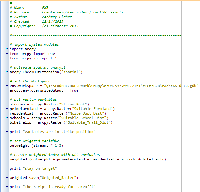
Script 3:
The last script of the semester takes the rasters I made in EX8 for the risk/impact assessment and creates a weighted index from them. The output of the python script is the same as the output of the calculate raster tool for the risk/impact part of EX8, except that in my scenario, the streams is weighted more than the others.
No comments:
Post a Comment